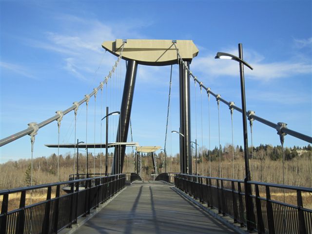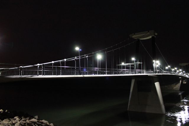
For more than seventy-five years, municipal, regional and provincial authorities have sought to protect the valley’s natural open space from urban development and provide a park system suitable for a metropolitan area.

Edmonton’s River Valley is considered its greatest asset. The City of Edmonton wants to highlight the River Valley with new structures that make a signature design statement, have the least environmental impacts and are built to last.

What's New

  • Fort Edmonton Footbridge and Trails System Open to Public:
    November 17, 2010 - First walkable span built in 15 years connects south, west Edmonton trails
    • Final landscaping completed in 2011
    • Patricia Ravine Trails and Wolf Willow Ravine Bridge components are complete. 
    • July 2010 Information Notice
    • Construction of the Fort Edmonton Footbridge and Trails began in August 2008.


  • When Visiting Fort Edmonton Footbridge:
    • West side parking is located along Wanyandi Way in the Oleskiw neighbourhood
    • East side parking is located along 58th Avenue NW in the Brander Gardens neighbourhood
    • If you require parking closer to the footbridge you can access a small parking and turnaround area located at the end of Whitemud Road NW.
      • Access via 58th Avenue NW
      • 2 hour time limit applies

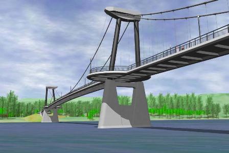
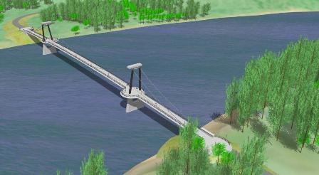
Graphic rendering depicting Fort Edmonton footbridge.Graphic rendering depicting Fort Edmonton footbridge.

Project Background

Edmonton City Council approved the Fort Edmonton Footbridge project within the Ribbon of Green Concept (1990) and Ribbon of Green Master Plan (1992) documents. It further supported completion of the River Valley Plan in the Community Services Integrated Services Strategy (2000), the Urban Parks Management Plan (2006), and the Capital Region River Valley Park – Plan of Action (2007) prepared by the River Valley Alliance.

Growth in south west and west end communities is anticipated to create demands from an additional 143,000 residents in the next 10 years. This growth is contributing to an increasing demand for access to recreation services and facilities in the river valley park system.

The importance of trails and footbridges within the river valley was confirmed in a city-wide telephone survey (City of Edmonton; 2005). In this survey 85% of park users stated continuous trails and footbridges were very important to their enjoyment of the river valley. Public Consultation on this project included interviews with residents and key stakeholders, an information mail-out and survey, information and a survey on the City web site, and two open house meetings with the communities near the footbridge. Public feedback on the project was very positive and is summarized in the following themes:

  • Bridge design comments were predominantly supportive.
  • General comments expressing support for the project and congratulating the project team for a job well done.
  • Encouragement to get the project underway and completed as soon as possible.
  • Parking in residential areas is a concern and should be monitored. 
  • Stairs and access to the river valley should be improved where possible while still preserving the natural environment.

The footbridge crosses the North Saskatchewan River upstream of Fort Edmonton Park and affords a connection between the new multi-use Trans Canada Trail around Fort Edmonton Park and new park land purchased on the west side of the river (Centennial Lands) in 2007. The Fort Edmonton Footbridge will enhance Edmonton's extensive trail system by creating a key link between the north and south sides of the river. Trail connections will be improved to access the footbridge and to connect future trails leading south to the city limits and south through the Capital Region.

Bridge Design

The design of this footbridge was selected to achieve the objective of “better design in a world class city” and is considered reasonable value for a signature facility with “in-river” construction requirements.

  • The design selected for the footbridge offers the least amount of environmental disruption within the North Saskatchewan River, both permanently and during construction.
  • This design was the only one with just two piers in the river, meaning less impact on the river environment.
  • The project helps the City to achieve goals of sustainable transportation and healthy communities by encouraging walking, cycling and non-motorized transportation.
  • The total project cost of $28.2 million includes the overall planning, design, engineering, environmental permitting, public consultation and actual construction of the footbridge, 2.5 km of access trails and stairs, and a secondary bridge crossing at Wolf Willow Ravine.

Location

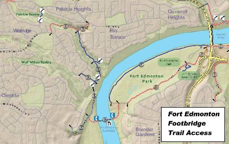
The Fort Edmonton Footbridge is being constructed at the Southwest end of Fort Edmonton Park, over the river to City land below the new Wolf Willow Ridge subdivision. Trail connections will be improved to access the footbridge.

Fort Edmonton Footbridge Location Map

Timeline


Stage Date
Public Consultation April and November 2007
Submit To Council for Budget Approval  December 2007
Complete design April 2008
Construct Footbridge 2008 - 2010

Funding

The project budget is $28.2 million. Funding for the project was identified in the 2008 City budget.

Feedback

Phase 2 Final Report

Phase 2 Final Report - June 24, 2008

Appendix A - Display Panels

Appendix B - Open House #2 Presentation

Appendix C - Open House #2 Participant Survey Form

Appendix D - Participant Survey Compilation - Final

Photo Gallery