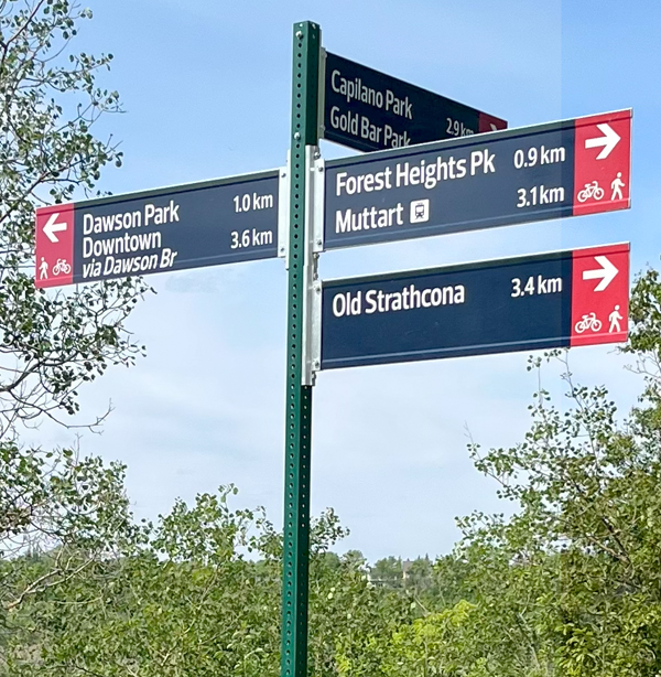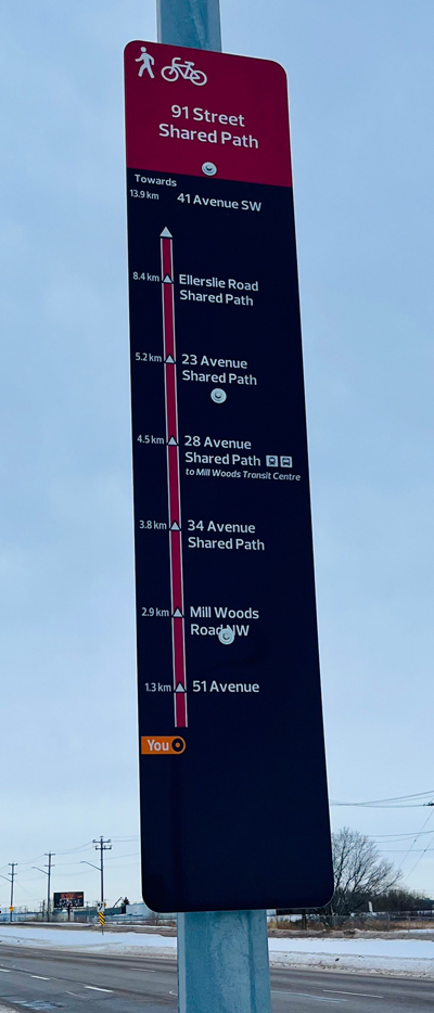
A bike wayfinding sign with distances and directions to several destinations near Saskatchewan Drive.
About The Project
Creating consistent styles of wayfinding signs for biking, walking and rolling is an important part of improving the way citizens and visitors enjoy the city and find their way to important destinations. The City of Edmonton is committed to the creation of a city that is bike-friendly, more walkable and has accessible transit.
The new bike route wayfinding coordinates with the River Valley Wayfinding Signage and the Pedestrian Wayfinding Standard, and is designed to improve wayfinding for all users of the active mobility network. Feedback from Edmontonians through The Bike Plan public engagement process told us very clearly that people want better wayfinding.
The Bike Plan guides the planning and design of Edmonton’s bike network and programs and suggests ways to create better wayfinding:
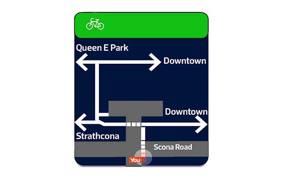
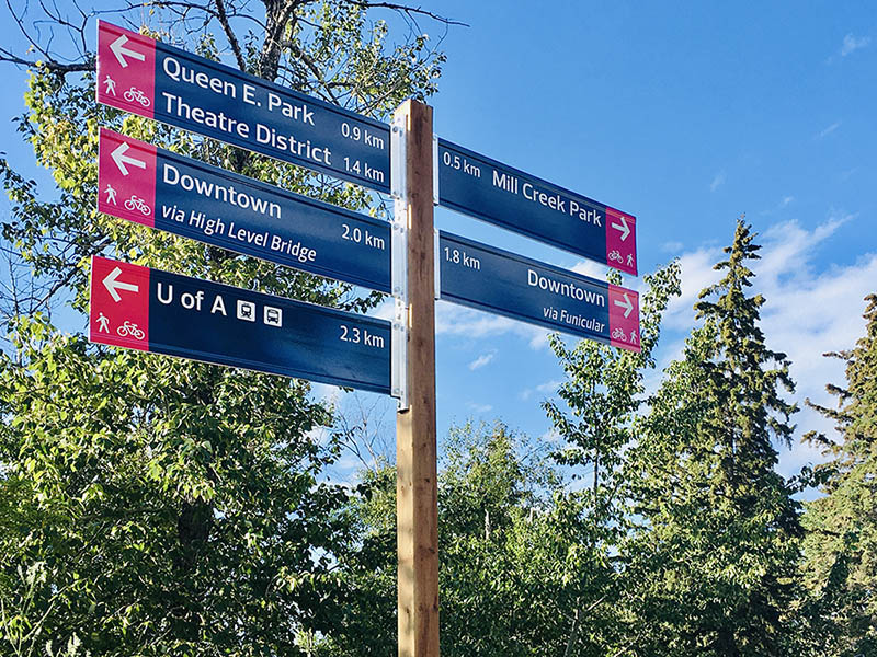
- Develop and implement a bike wayfinding system, similar to other City wayfinding systems, that includes bikeway network signage with information on destinations, distances or travel times, and route orientation
- Remove existing bike wayfinding elements that are not consistent with the system (such as removing old bike route signs)